
The Hills of Napa
The Hills of Napa
RANKING FROM TOUGHEST TO NOT SO TOUGH
Hills provide a challenge, a chance to get into condition, a good look at varied scenery, and the only access to those great descents. The following is a listing and ranking of most of the hills in Napa. I used an Avocet 50 computer for altitude gain and distance. The greater the incline the more feet climbed per mile. The Napa hills range from 650 ft/mi. which in some circles computes to an 18% grade (not according to my trigonometry book) to 174 ft/mi. They are also ranked from most difficult to easiest which can be somewhat subjective. I base how hard they are usually on how steep but sometimes that’s not the whole story. If two hills are practically the same pitch but one has no breaks, it will be ranked harder.
1) OAKVILLE GRADE (from Hwy 29) 650 ft/mi. Without a doubt the toughest climb in Napa. it’s not that far but it starts out tough and gets alot tougher. You climb 650 feet in exactly one mile. No breaks, no shade, no fun. The first half isn’t so bad and I can manage it sitting in the saddle using my 39/28. The last half increases in pitch and it’s standing and grunting all the way at a 3.5 mph pace.
2) SPRING MTN (starting from St Helena) 526 ft/mi. I rank this second even though there are two other climbs that are steeper, but this one is longer and there are essentially no breaks. Total distance (from Y in the road to county line) is 4.5 miles and total elevation gain is 1560 feet. The major pitch however is 1.9 miles long and 1000 ft with virtually no breaks. It is covered in shade which helps but I’ve only attempted this twice in 7 years just to give you an idea of how much I enjoy this one.
3) SODA CANYON RD. 633 ft/mi. This is a dead end off of the Silverado Trail. Very pretty ride and it takes about 4 miles of not so difficult climbing to get to the real climb. Total distance from Silverado Trail to the peak is 6.1 miles and elevation gain is 1340 feet. The major pitch starts at the fire station 4 miles in and is 1.2 miles with 760 feet of climbing. There are only a couple of short breaks once you start the major climb. No shade, no fun.
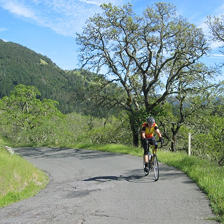
4) WILD HORSE VALLEY RD. 600 ft/mi. This is also a dead end that is a continuation of Coombsville Rd. Total distance (from small bridge to peak) is 2.4 miles and 1210 feet of climbing. The major pitch starts at the Y and is 1.6 miles with 960 feet of elevation gain. This one is actually fun, has some great views, and some breaks. I break it down into three sections, the first third is toughest, middle third flatter and has some breaks, and the last third gets tougher again but still has some breaks.
5) HOWELL MTN. (from the Pope Valley side) 504 ft/mi. This is the alternative to Ink Grade and most people don’t take it. Total distance is 2.2 miles with 1110 feet of climbing. Lots of shade, nice scenery, not alot of breaks but I still have fun on this one.
6) TRINITY RD. (from the Sonoma Hwy 12 side) 480 ft/mi. I start the climb about a mile in from Hwy 12 just at a sharp right hairpin turn. From there to the fire station at the top it’s 2.5 miles and 1200 feet of climb. The first and last third are the toughest with the middle third easiest with more breaks. No shade but still fun.
7) TRINITY RD. (from the Napa side) 474 ft/mi. Along with Mt Veeder this is one of my favorites. Lots of shade, great descent, great views. Total distance from the first right hand turn to the first vineyard beyond the county line is 1.9 miles and 900 feet of climbing.
8) CAVEDALE RD. 410 ft/mi. The total distance is 7.0 miles from Hwy 12 on the Sonoma side to the fire station on Trinity and 1850 feet of climb. The major pitch is 4.0 miles with 1640 feet. This is a very poorly maintained road with lots of potholes and bumps so it breaks your concentration. Very little shade and some tough pitches toward the end. Although I rank Trinity harder I prefer to climb it rather than this brain rattler – do not take this road on your descent unless you like building wheels.
9) PARTRICK RD. 380 ft/mi. This one is a dead end off of Browns Valley Rd. It has a very tough little pitch toward the start, some shade but mostly open, and a great descent but watch for the cattle guards (2). Total distance is about 4 miles from Browns Valley Rd. to where it breaks into a Y of driveways. I don’t know the total elevation gain but suspect it’s around 1300 feet. However, the major pitch is 2.0 miles and 760 feet. At the beginning there’s a 0.5 mile climb of 300 feet gain which is a 600 ft/mi. pitch. That one little pitch is why it’s ranked 9th instead of lower.
10) MT VEEDER (from Dry Creek side) 486 ft/mi. Total distance is 4.0 miles to the last peak (there are several) and 720 ft of elevation gain. This elevation gain is the elevation at the end minus elevation at the beginning not the total amount of climbing you do but in order to get that figure I have to remember to zero out my computer at the beginning which I haven’t done yet. Anyway this is a beautiful mountain and a gorgeous ride. The major pitch is 0.7 miles and 340 feet. Continuing on you go 1.8 miles with 650 feet of climb. Lots of flats and rollers and gentler climbs to the final peak. One heck of a great downhill after that. Plenty of shade. Part of our 100 miler on the Tour of the Napa Valley.
11) MT VEEDER (from the Redwood Rd/Browns Valley side) 458 ft/mi. Starting at Browns Valley Rd/Redwood you have a gentle climb for 6.0 miles with 600 feet of climbing. Lots of shade, pretty scenery with babbling brook on your right. After that the major pitch is 1.2 miles and 550 feet of climb. About 3/4 of the way there’s a nice flat break of 100 yards or so to the last pitch to the top. One of my favorites.
12) ATLAS PEAK 350 ft/mi. This is another dead end but quite beautiful, especially in the spring with a chance for a waterfall. The total distance from Westgate Dr. to the end is 8.3 miles with 1830 feet elevation gain. There are several peaks and the first and last are the most difficult. The first peak is 2.6 miles with 910 feet of climbing (watch for the waterfall to your right), then a flat section, rollers and a not so difficult climb to the second peak. After that you go downhill for 1/2 mile or so and then the road narrows for the last third with a few tough pitches. The ride back down is both scenic and a blast.
13) MT GEORGE (going east on 121) 333 ft/mi. Total distance is 3.3 miles with 1100 feet of climbing. Kind of boring, fairly open and fairly steady climb though not very difficult. Very nice coming back down though.
14) HOWELL MTN. (Napa Valley side off of Silverado Trail) 271 ft/mi. Total distance from the split with Conn Valley Rd to the top of the hill before Angwin (take Rt on Deer Park) is 4.1 miles and 1110 ft of climbing. Very pretty ride on a narrow road with great views, little traffic and plenty of shade.
15) INK GRADE 247 ft/mi. Total distance from Pope Valley Rd. to White Cottage is 4.5 miles and 1110 feet of climbing. Very nice ride with plenty of shade, lots of breaks especially at the start. One of the longer climbs in Napa but not as difficult as most. Also part of our righteous Tour of the Napa Valley.
16) OAKVILLE GRADE (Dry Creek side) 254 ft/mi. Might be steeper than Ink Grade but doesn’t feel like it and it’s much shorter. Total distance is 1.3 miles with 330 elevation gain. Watch out for that descent on the other side though, it’s a screamer.
17) REDWOOD RD. 174 ft/mi. This is a little dead end side road off of Mt Veeder and the turn off for Hess Winery (a stop worth making for a look at their art collection). This is probably the prettiest road in Napa with a babbling brook, waterfalls in spring, redwoods, narrow winding road, and vineyards. Total distance is 3.4 miles and 590 feet of climbing. Most of the climbs are at 267 ft/mi. difficulty but there are lots of flats and breaks with probably less than 2 miles of actual climbing. The last 0.2 miles are the most difficult.
That’s all there is to it, come on out to Napa and try a few, you might like it. -Bruce DeBell